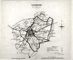
Canterbury. (from The Ordnance Survey).
A fine example with very attractive colouring.
£60.00
Publisher
House of Commons. n.d. but,
Date
1831
Synopsis
Boundary commission map.
Item Description
Lithographic map, 14 x 12 inches, with contemporary hand-colouring.
Notes
These maps were produced from the Ordnance Survey maps on a scale of 2 inches to one mile, to redefine the parliamentary boundaries, in this case joining the parishes or wards to become one constituency. The map is sold together with the pages of text and statistics which accompanied the map in the report.
[Stock No. 16652]
Subjects
19th Century • Canterbury • Kent • Maps • Towns